

DOI Heft:
No. 386 (May 1925)
DOI Artikel:Pictorial maps and prospects
DOI Seite / Zitierlink: https://doi.org/10.11588/diglit.21402#0262


PICTORIAL MAPS AND PROSPECTS.
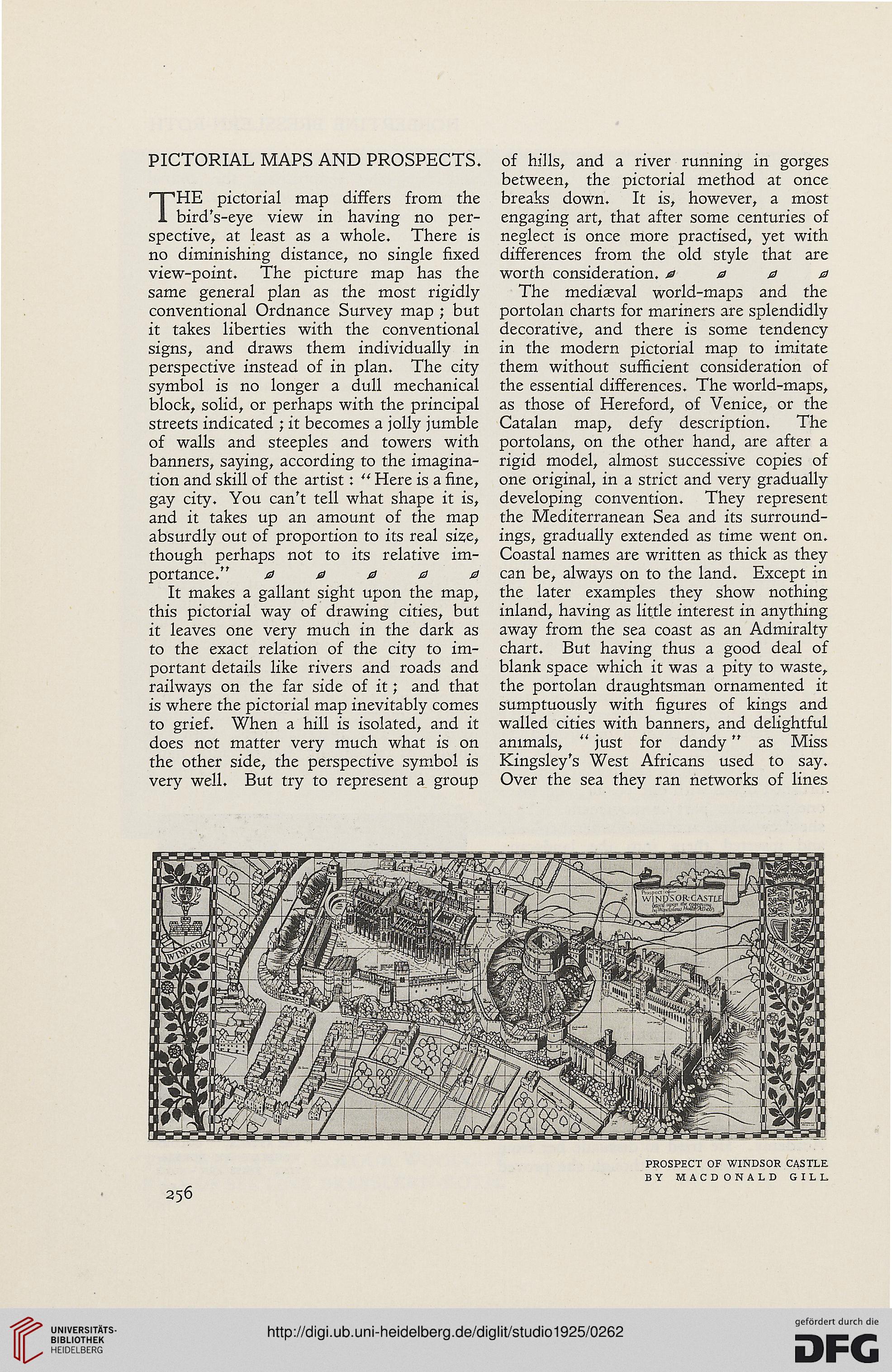
THE pictorial map differs from the
bird's-eye view in having no per-
spective, at least as a whole. There is
no diminishing distance, no single fixed
view-point. The picture map has the
same general plan as the most rigidly
conventional Ordnance Survey map ; but
it takes liberties with the conventional
signs, and draws them individually in
perspective instead of in plan. The city
symbol is no longer a dull mechanical
block, solid, or perhaps with the principal
streets indicated ; it becomes a jolly jumble
of walls and steeples and towers with
banners, saying, according to the imagina-
tion and skill of the artist: " Here is a fine,
gay city. You can't tell what shape it is,
and it takes up an amount of the map
absurdly out of proportion to its real size,
though perhaps not to its relative im-
portance." 0 0 0 0 0
It makes a gallant sight upon the map,
this pictorial way of drawing cities, but
it leaves one very much in the dark as
to the exact relation of the city to im-
portant details like rivers and roads and
railways on the far side of it; and that
is where the pictorial map inevitably comes
to grief. When a hill is isolated, and it
does not matter very much what is on
the other side, the perspective symbol is
very well. But try to represent a group
of hills, and a river running in gorges
between, the pictorial method at once
breaks down. It is, however, a most
engaging art, that after some centuries of
neglect is once more practised, yet with
differences from the old style that are
worth consideration. 0000
The mediaeval world-maps and the
portolan charts for mariners are splendidly
decorative, and there is some tendency
in the modern pictorial map to imitate
them without sufficient consideration of
the essential differences. The world-maps,
as those of Hereford, of Venice, or the
Catalan map, defy description. The
portolans, on the other hand, are after a
rigid model, almost successive copies of
one original, in a strict and very gradually
developing convention. They represent
the Mediterranean Sea and its surround-
ings, gradually extended as time went on.
Coastal names are written as thick as they
can be, always on to the land. Except in
the later examples they show nothing
inland, having as little interest in anything
away from the sea coast as an Admiralty
chart. But having thus a good deal of
blank space which it was a pity to waste,
the portolan draughtsman ornamented it
sumptuously with figures of kings and
walled cities with banners, and delightful
animals, " just for dandy" as Miss
Kingsley's West Africans used to say.
Over the sea they ran networks of lines