

DOI issue:
Egypt
DOI article:Herbich, Tomasz; Smekalova, Tatʹjana Nikolaevna: Dakhleh Oasis: magnetic survey 1999-2000
DOI Page / Citation link:https://doi.org/10.11588/diglit.41368#0262


DAKHLEH OASIS
EGYPT
METHOD AND EQUIPMENT
Two different instruments were used for
the survey. Smekalova used Overhauser
magnetometer GSM-19WG by Gem
systems (Canada). One sensor of the
instrument served as a base point; the
signal of the traversing sensor and the base
station were subtracted to remove
temporal daily variations of the Earth's
magnetic field. Herbich used a fluxgate
gradiometer FM-36 by Geoscan Research
(England).
The measurements were taken along
lines 0.5 m apart, the actual points of meas-
urement on a line being spaced 0.3-0.4 m
(Overhauser) and 0.5 m (FM-36). Survey
height was c. 0.3 m above the surface.
SURVEY RESULTS
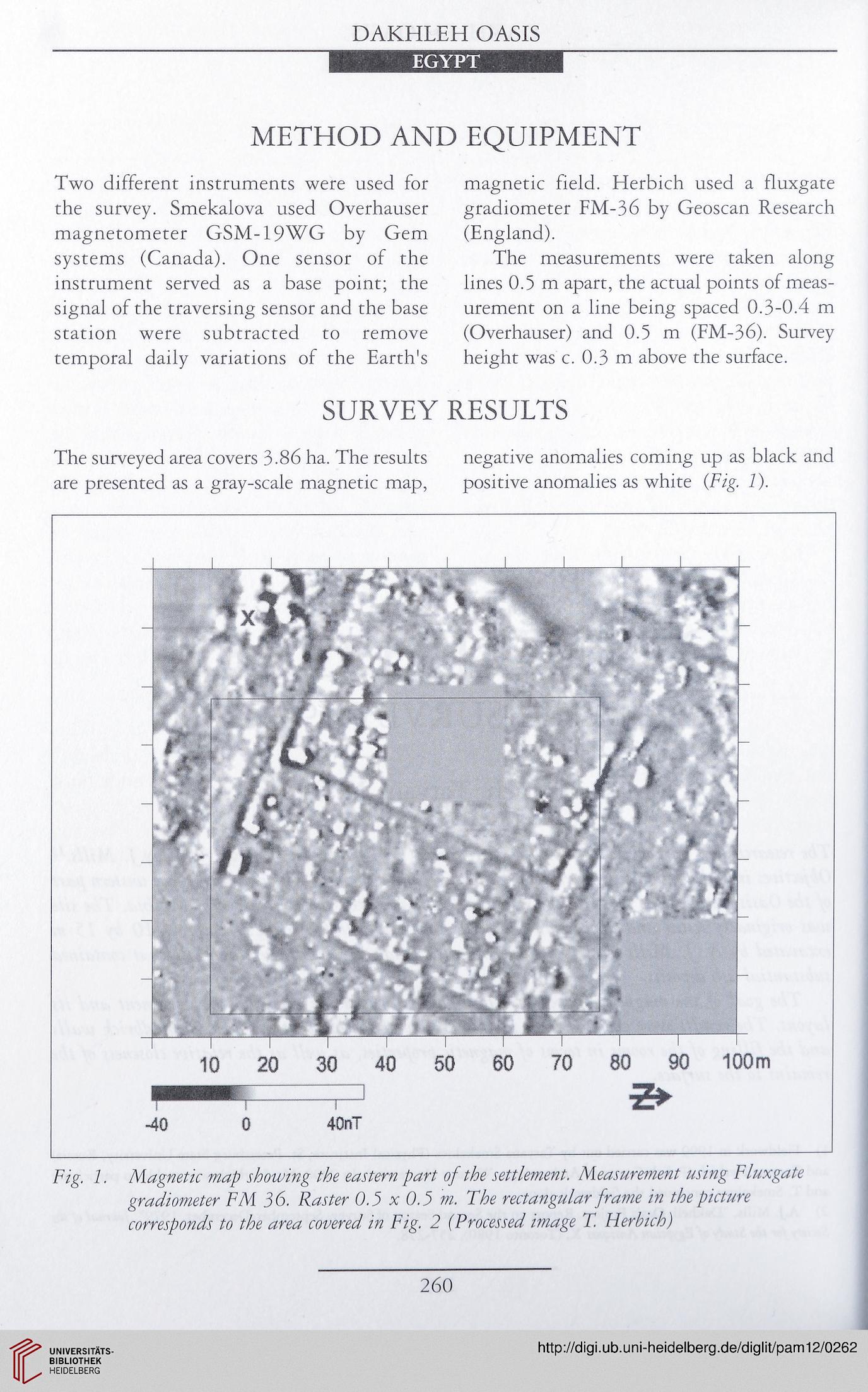
The surveyed area covers 3.86 ha. The results negative anomalies coming up as black and
are presented as a gray-scale magnetic map, positive anomalies as white (Fig. 1).
Fig. 1. Magnetic map showing the eastern part of the settlement. Measurement using Fluxgate
gradiometer FM 36. Raster 0.3 x 0.3 m. The rectangular frame in the picture
corresponds to the area covered in Fig. 2 (Processed image T. Herbich)
260
EGYPT
METHOD AND EQUIPMENT
Two different instruments were used for
the survey. Smekalova used Overhauser
magnetometer GSM-19WG by Gem
systems (Canada). One sensor of the
instrument served as a base point; the
signal of the traversing sensor and the base
station were subtracted to remove
temporal daily variations of the Earth's
magnetic field. Herbich used a fluxgate
gradiometer FM-36 by Geoscan Research
(England).
The measurements were taken along
lines 0.5 m apart, the actual points of meas-
urement on a line being spaced 0.3-0.4 m
(Overhauser) and 0.5 m (FM-36). Survey
height was c. 0.3 m above the surface.
SURVEY RESULTS
The surveyed area covers 3.86 ha. The results negative anomalies coming up as black and
are presented as a gray-scale magnetic map, positive anomalies as white (Fig. 1).
Fig. 1. Magnetic map showing the eastern part of the settlement. Measurement using Fluxgate
gradiometer FM 36. Raster 0.3 x 0.3 m. The rectangular frame in the picture
corresponds to the area covered in Fig. 2 (Processed image T. Herbich)
260