

DOI Heft:
Egypt
DOI Artikel:Kuciewicz, Ewa; Jaroni, Eliza; Kobusiewicz, Michał: Dakhleh Oasis: Petroglyph unit, rock art research, 2007
DOI Seite / Zitierlink:https://doi.org/10.11588/diglit.42093#0312


DAKHLEH
EGYPT
PAINTED WADI
Recording rock art sites in the so-called
Painted Wadi remained the main objective
of the project [Fig. 2\. Documentation in
the previous season had covered the central
part of the wadi (Kuciewicz, Jaroni,
Kobusiewicz 2009), whereas in 2007 a
comprehensive survey was undertaken of the
northern part, close to the modern road
leading from Dakhleh to Khargah.
Fieldwork was confined to an area
marked by the following four corner points:
GPS 1: N25°32’08.1” EO29°09’54.8”
GPS 2: N25°32’09.2” EO29°09’49.8”
GPS 3: N25°30’48.2” EO29°09’44.4”
GPS 4: N25°30’47.9” EO29°09’39.5”
Thorough surveying of this belt, more or
less 2 km long and approx. 300 m wide, has
Fig. 1. Decorated sandals image of Dynastic
date (Photo E. Kuciewicz)
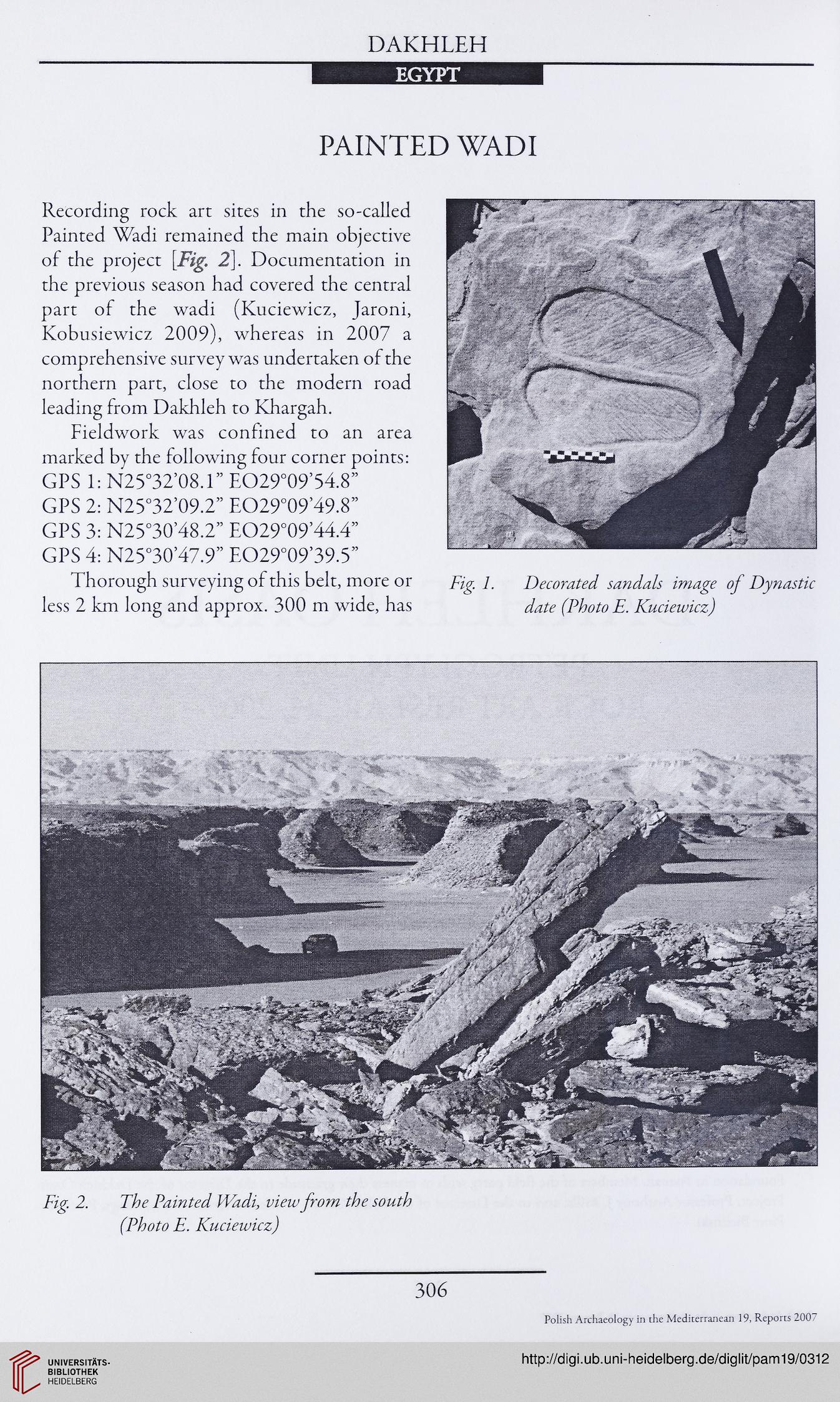
Fig. 2. The Painted Wadi, view from the south
(Photo E. Kuciewicz)
306
Polish Archaeology in the Mediterranean 19, Reports 2007
EGYPT
PAINTED WADI
Recording rock art sites in the so-called
Painted Wadi remained the main objective
of the project [Fig. 2\. Documentation in
the previous season had covered the central
part of the wadi (Kuciewicz, Jaroni,
Kobusiewicz 2009), whereas in 2007 a
comprehensive survey was undertaken of the
northern part, close to the modern road
leading from Dakhleh to Khargah.
Fieldwork was confined to an area
marked by the following four corner points:
GPS 1: N25°32’08.1” EO29°09’54.8”
GPS 2: N25°32’09.2” EO29°09’49.8”
GPS 3: N25°30’48.2” EO29°09’44.4”
GPS 4: N25°30’47.9” EO29°09’39.5”
Thorough surveying of this belt, more or
less 2 km long and approx. 300 m wide, has
Fig. 1. Decorated sandals image of Dynastic
date (Photo E. Kuciewicz)
Fig. 2. The Painted Wadi, view from the south
(Photo E. Kuciewicz)
306
Polish Archaeology in the Mediterranean 19, Reports 2007