

DOI Artikel:
Lerche, Grith; Steensberg, Axel: Tools and tillage in Iran: observations made in 1965 in the province of Kermán
DOI Seite / Zitierlink:https://doi.org/10.11588/diglit.49001#0230


218
LERCHE • STEENSBERG
However, to the south c. 10 km from Sirjan,
the soil consists of 40-70 % silt, the remain-
der being mostly sand, and there is practical-
ly no gravel.1 This region is settled with
villages in a belt along the road to Bandar
Abbas which forms the main basis of the
existence of Sirjan.
To the NE of Sirjan a mountain range
running NW-SE begins about 20 km NE of
Hussein abad, and only 10 km from Sirjan
camels can be seen browsing in groups of 4-6
together led by a man and his dog. The
monotonous landscape with dispersed thor-
ny halophytes is diversified by wells of
qanats2 maintained or in poor condition.
Qanats are artificially built subterranean wa-
ter canals, which drain the groundwater of
the mountains, conducting it over distances
of 10 km or more to the villages that usually
have no other supply for irrigating their
fields and gardens, or for their households.
Wells are dug at intervals of 50-200 m, the
shortest distances being near the outlet. At
the foot of the mountains the wells may be
75 m deep, and in fact wells of up to 300 m
depth have been observed in some regions,
the bottom sloping at only about 0.5-1 %o in
order to avoid erosion. The digging of such
Fig. 1. Map of Iran. Karte des Irans.
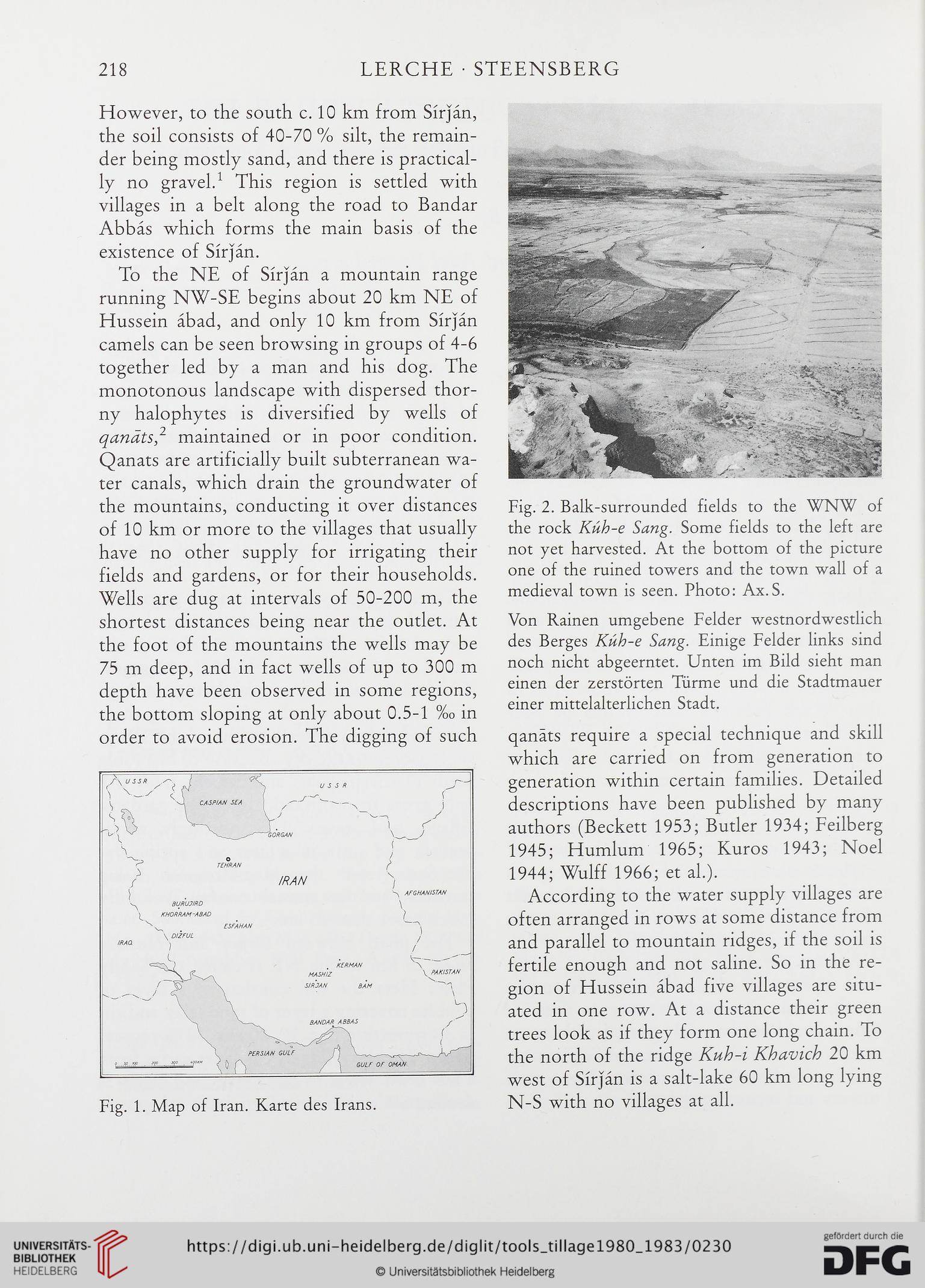
Fig. 2. Balk-surrounded fields to the WNW of
the rock Kuh-e Sang. Some fields to the left are
not yet harvested. At the bottom of the picture
one of the ruined towers and the town wall of a
medieval town is seen. Photo: Ax.S.
Von Rainen umgebene Felder westnordwestlich
des Berges Kuh-e Sang. Einige Felder links sind
noch nicht abgeerntet. Unten im Bild sieht man
einen der zerstorten Tiirme und die Stadtmauer
einer mittelalterlichen Stadt.
qanats require a special technique and skill
which are carried on from generation to
generation within certain families. Detailed
descriptions have been published by many
authors (Beckett 1953; Butler 1934; Feilberg
1945; Humlum 1965; Kuros 1943; Noel
1944; Wulff 1966; et al.).
According to the water supply villages are
often arranged in rows at some distance from
and parallel to mountain ridges, if the soil is
fertile enough and not saline. So in the re-
gion of Hussein abad five villages are situ-
ated in one row. At a distance their green
trees look as if they form one long chain. To
the north of the ridge Kuh-i Khavich 20 km
west of Sirjan is a salt-lake 60 km long lying
N-S with no villages at all.
LERCHE • STEENSBERG
However, to the south c. 10 km from Sirjan,
the soil consists of 40-70 % silt, the remain-
der being mostly sand, and there is practical-
ly no gravel.1 This region is settled with
villages in a belt along the road to Bandar
Abbas which forms the main basis of the
existence of Sirjan.
To the NE of Sirjan a mountain range
running NW-SE begins about 20 km NE of
Hussein abad, and only 10 km from Sirjan
camels can be seen browsing in groups of 4-6
together led by a man and his dog. The
monotonous landscape with dispersed thor-
ny halophytes is diversified by wells of
qanats2 maintained or in poor condition.
Qanats are artificially built subterranean wa-
ter canals, which drain the groundwater of
the mountains, conducting it over distances
of 10 km or more to the villages that usually
have no other supply for irrigating their
fields and gardens, or for their households.
Wells are dug at intervals of 50-200 m, the
shortest distances being near the outlet. At
the foot of the mountains the wells may be
75 m deep, and in fact wells of up to 300 m
depth have been observed in some regions,
the bottom sloping at only about 0.5-1 %o in
order to avoid erosion. The digging of such
Fig. 1. Map of Iran. Karte des Irans.
Fig. 2. Balk-surrounded fields to the WNW of
the rock Kuh-e Sang. Some fields to the left are
not yet harvested. At the bottom of the picture
one of the ruined towers and the town wall of a
medieval town is seen. Photo: Ax.S.
Von Rainen umgebene Felder westnordwestlich
des Berges Kuh-e Sang. Einige Felder links sind
noch nicht abgeerntet. Unten im Bild sieht man
einen der zerstorten Tiirme und die Stadtmauer
einer mittelalterlichen Stadt.
qanats require a special technique and skill
which are carried on from generation to
generation within certain families. Detailed
descriptions have been published by many
authors (Beckett 1953; Butler 1934; Feilberg
1945; Humlum 1965; Kuros 1943; Noel
1944; Wulff 1966; et al.).
According to the water supply villages are
often arranged in rows at some distance from
and parallel to mountain ridges, if the soil is
fertile enough and not saline. So in the re-
gion of Hussein abad five villages are situ-
ated in one row. At a distance their green
trees look as if they form one long chain. To
the north of the ridge Kuh-i Khavich 20 km
west of Sirjan is a salt-lake 60 km long lying
N-S with no villages at all.