

DOI Artikel:
Lerche, Grith: A century old survey of "Celtic" fields in Jutland
DOI Seite / Zitierlink:https://doi.org/10.11588/diglit.49002#0063


CELTIC FIELDS
61
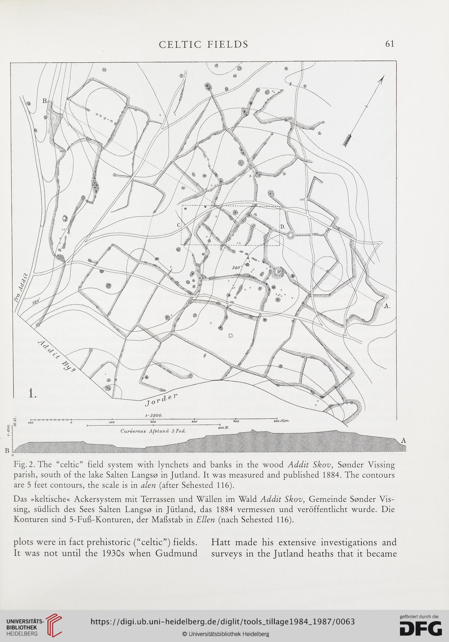
Fig. 2. The “Celtic” field system with lynchets and banks in the wood Addit Skov, Sender Vissing
parish, south of the lake Salten Langse in Jutland. It was measured and published 1884. The contours
are 5 feet contours, the scale is in alen (after Sehested 116).
Das »keltische« Ackersystem mit Terrassen und Wallen im Wald Addit Skov, Gemeinde Sender Vis-
sing, siidlich des Sees Salten Langse in Jutland, das 1884 vermessen und verbffentlicht wurde. Die
Konturen sind 5-FuE-Konturen, der Mafistab in Ellen (nach Sehested 116).
plots were in fact prehistoric (“celtic”) fields. Hatt made his extensive investigations and
It was not until the 1930s when Gudmund surveys in the Jutland heaths that it became
61
Fig. 2. The “Celtic” field system with lynchets and banks in the wood Addit Skov, Sender Vissing
parish, south of the lake Salten Langse in Jutland. It was measured and published 1884. The contours
are 5 feet contours, the scale is in alen (after Sehested 116).
Das »keltische« Ackersystem mit Terrassen und Wallen im Wald Addit Skov, Gemeinde Sender Vis-
sing, siidlich des Sees Salten Langse in Jutland, das 1884 vermessen und verbffentlicht wurde. Die
Konturen sind 5-FuE-Konturen, der Mafistab in Ellen (nach Sehested 116).
plots were in fact prehistoric (“celtic”) fields. Hatt made his extensive investigations and
It was not until the 1930s when Gudmund surveys in the Jutland heaths that it became